Pre-Planning Specialist

Unlock Hidden Land Value Before You Call a Builder

We help homeowners, real estate agents, and investors map out local zoning lines, property restrictions, and structural feasibility—saving thousands of dollars in planning mistakes and your valuable time.

Moderate ADU Impact
+20-30%
Added Property Value
Average Value Added
+$180 / SQ FT
Across Entire Lot
Asset Liquidity
2.5x
Faster Resale

Virginia Senate Bill 531

The 2027 Accessory Dwelling Unit (ADU) Shift

On July 1, 2027, Virginia transforms residential real estate by legalizing detached accessory structures (like backyard homes, cottage flats, and garage apartments) by-right statewide. This wipes away historical occupancy rules and long municipal public hearings.

This is a massive new opportunity to turn empty property lines you already own into predictable rental income, family living spaces, or significantly higher resale valuations.

However, city codes, lot coverage thresholds, and yard limits will still dictate structural margins. Before you hire a contractor, our clean property feasibility reports ensure your yard footprint is perfectly calculated, formatted, and ready to pass local ordinances.
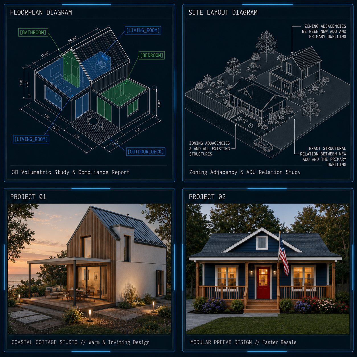
Optimal Design VA Spatial Architectural Sample

The Foundation Before the Build

Architects draw it out and contractors swing the hammers. We provide the hard spatial data and zoning intelligence so you know exactly what you are legally allowed to build and where.

GIS DATA

Zoning & Lot Analysis

A deep digital review of your property line setbacks, total yard space allowance, and local municipal guidelines to find exactly where you can legally build without penalty.

RENDER ASSETS

3D Site Layout Models

Accurate, straightforward 3D scale models showing how a new unit will realistically sit in your backyard—allowing you to evaluate space, shadows, and privacy risk-free.

DATA PACKAGES

Pre-Architect Site Prep

We bundle clean, accurate property data packages that you can hand straight to licensed builders or architects so they can jump directly into blueprints with zero guesswork.

How It Works

A streamlined 3-step feasibility process designed to give you clarity and confidence before spending thousands on architectural drawings or permits.

Step 01

GIS Parcel Audit

We access official municipal parcel maps, setback buffers, flood zones, and easement boundaries for your specific address.

Step 02

3D Footprint & Spatial Modeling

We identify and map your allowable building envelope to verify total lot coverage and structure placement before design begins.

Step 03

Feasibility Report

Receive a clean data package and site diagnostic report ready to hand off directly to our preferred service provider or your own licensed architect or engineer.

Start a Property Assessment

Enter your parcel details below to evaluate your property's development options.

Prefer to reach out directly?

Skip the automated system and connect with us directly:

info@optimaldesignva.com (757) 754-9847